Δημοσίευση σε Επιστημονικό Συνέδριο: “Comparative analysis of SLAM and TLS LiDAR technologies for biodiversity relevant information extraction over two Natura 2000 Sites in Greece”

Δημοσίευση σε Επιστημονικό Συνέδριο: “Comparative analysis of SLAM and TLS LiDAR technologies for biodiversity relevant information extraction over two Natura 2000 Sites in Greece”
“The General Assembly 2025 of the European Geosciences Union (EGU)” 27 Απριλίου – 2 Μαϊου, 2025 • Βιέννη, Αυστρία.
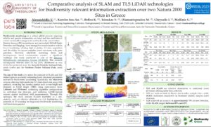
Comparative analysis of SLAM and TLS LiDAR technologies
for biodiversity relevant information extraction over two Natura 2000
Sites in Greece
Alexandridis V. (1), Karolos Ion-An. (1), Bellos K. (1), Tsioukas V. (1), Diamantopoulou M. (2), Chrysafis I. (1), Mallinis G.(1)
(1) School of Rural and Surveying Engineering, Cadastre, Photogrammetry & Remote Sensing Unit (PERS Lab), Aristotle University, Thessaloniki, Greece
(2) School of Agriculture, Forestry and Natural Environment, Department of Forestry and Natural Environment, Aristotle University, Thessaloniki, Greece
INTRODUCTION
Biodiversity monitoring is a critical global priority, requiring reliable and precise information on forest and tree attributes to ensure sustainable management and biodiversity conservation. Remote Sensing (RS) technologies, and particularly LiDAR (Light Detection and Ranging), have emerged as transformative tools in forest monitoring, offering high-resolution 3D data acquisition and the ability to capture complex forest structures with great precision. However, effectively surveying dense and heterogeneous forest environments remains a significant challenge. The study, conducted as part of the hELlenic BIOodiversity Information System (EL-BIOS). This research encompasses selected three 0.1 ha plots, distributed in two distinctive protected areas: the Kotychi–Strofylia National Park, south Greece and the Northern Pindos National Park, north Greece.
The aim of the study is to assess the potential of SLAM and TLS technologies in accurately estimating forest structural parameters relevant to biodiversity monitoring. Specifically, the objectives include collecting high-resolution 3D point cloud data using both methods, extracting key forestry metrics such as tree height and diameter at breast height (DBH) using open-source tools: LAStools and 3D-Forest, optimizing algorithm configurations for individual tree detection, and validating LiDAR-derived outputs against traditional field measurements. Through this approach, the study assesses SLAM’s feasibility as a fast, portable, and cost-effective alternative to TLS, highlighting the potential of 3D scanning for large-scale biodiversity monitoring and forest management.
Κατεβάστε το πλήρες αρχείο: ΕΔΩ

